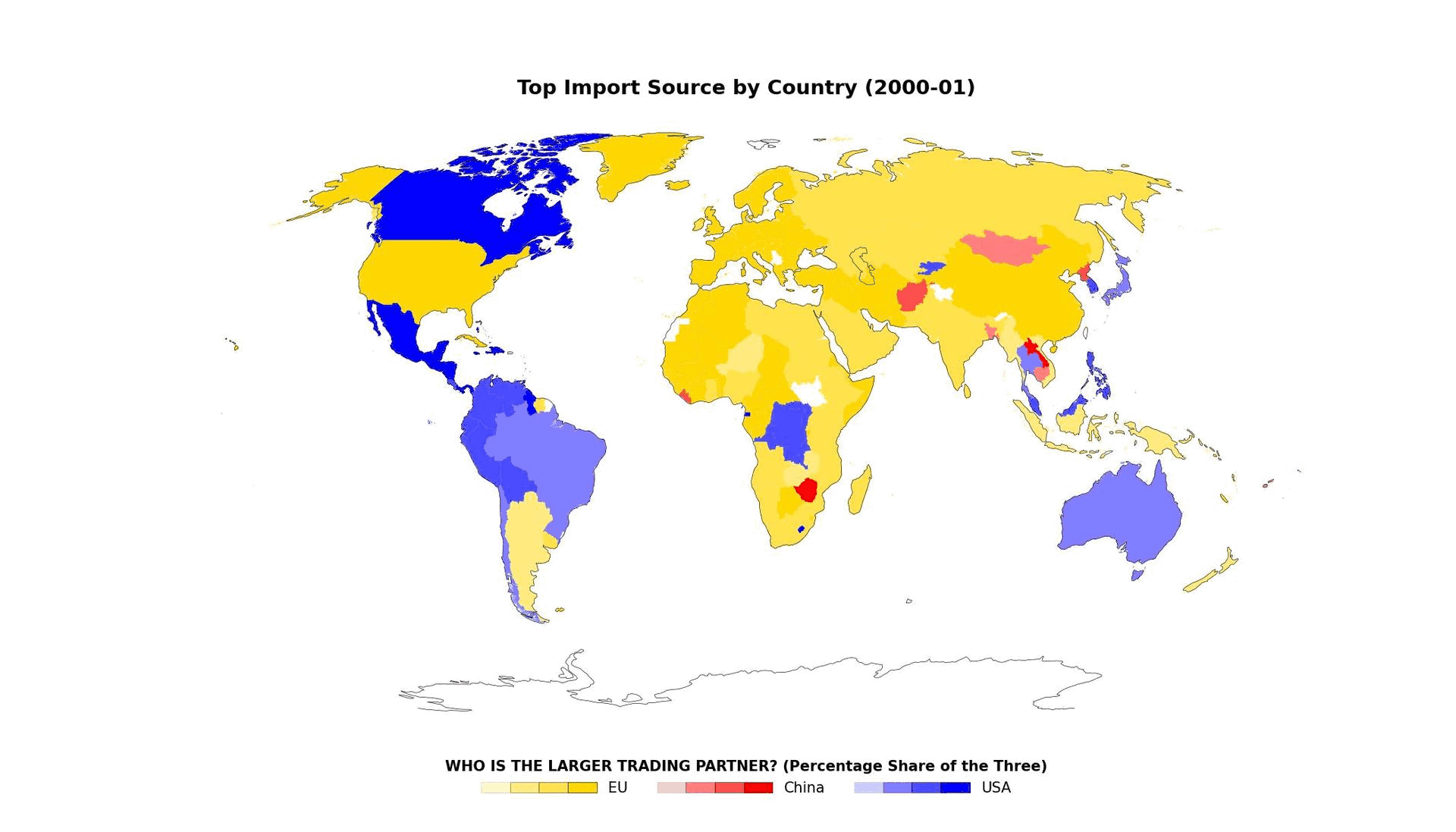
Project 7: Visualizing Global Imports from Major Economic Powers (China, EU, USA) since 2000
- Use IMF API to automatically collect relevant data soures
- Process data as needed
- Create metrics to define majority import (in this case which ever of the three countries the share of the imports are from)
- Combine geojson file with data so that there is a proper geospatial file with the neceesary information
- Creating visuals of the dataset
- Start to finish process in one Jupyter Notebook